Saturday, March 27, 2010

230 miles and growing...

The Cave Creek-Bradshaw Bikepack for next week is still growing with more singletrack. It has 18,000 feet of climbing with ~230 miles and is connecting the following:
T100
McDowells
Seven Springs
Spur Trail
Maricopa Trail
New River
Black Canyon Trail
Bradshaw Trail
Lane Mountain Trail


A sweet loop in the Bradshaws might come out of this, one that would allow you to do all of Black Canyon Trail (BCT), head up to Crown King on "singletrack" (used loosely here) and go down the south side of the Bradshaws on a combo of single/double track, loop back around north of Lake Pleasant to your car.

Scott and I are leaving to go ride up (north to south) Ripsey today on a 2-day bikepacking trip.

Thursday, March 25, 2010

More riding, warmer weather

Despite some rain clouds last Tuesday, Duncan and I met at Rubio's for the Tuesday ride. Having skipped the commute to work in the morning due to rain, I was a little under dressed for the ride. I was optimistic that the rain would begin to stop when we hit the trail.

Optimisim paid off, well, sort of. There was a slight drizzle throughout the ride. I am amazed at those dedicated riders that will continue to ride with me despite my stupid antics, riding in rain being one of them.

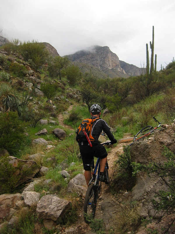
The rain only added to the difficulty of Lower Ram Canyon.


For those that have not ridden this newly found trail, it is like riding up Molino Basin with some random dashes of Green Mountain-type difficulty. It will test you and you will dab.


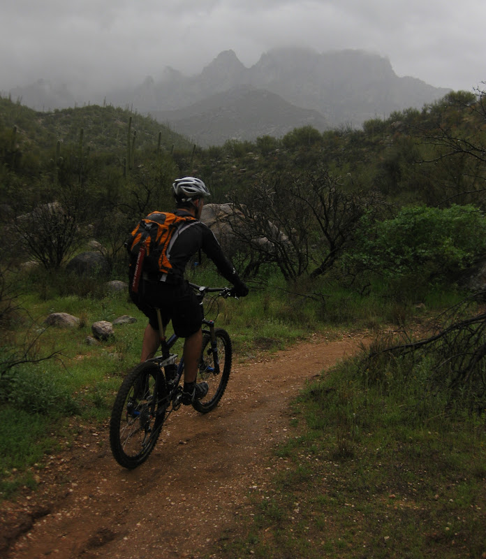
Lillies closed up....cold, wet technical riding. Most people would have just stayed home today.


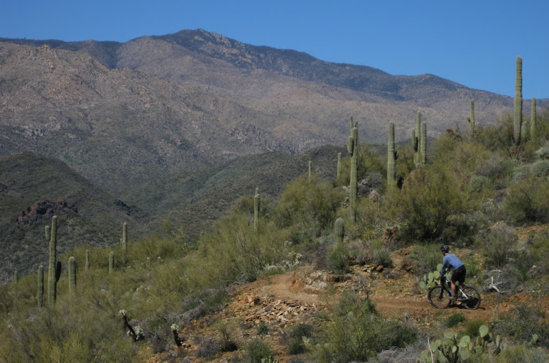
This was our first descent of this trail. Brillant, simply brillant. I was nailing everything for quite some time, no rock garden or tricky move could stay in my way.

Although that did not last the entire ride.


Duncan was having a great day also.


We headed up to try to find another route from Ramstein (the downhill descent from Pusch Ridge Dr).


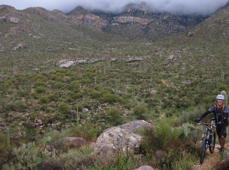
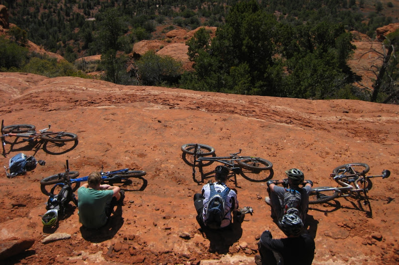
No such luck. After riding around a bit on the dirt road, we came back the same way. The camera stayed in the pocket the entire time (until the very end, see picture below); a true sign of a great descent.


So close to home, so many rocks.....I wish everyday was Tuesday.


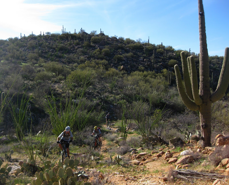
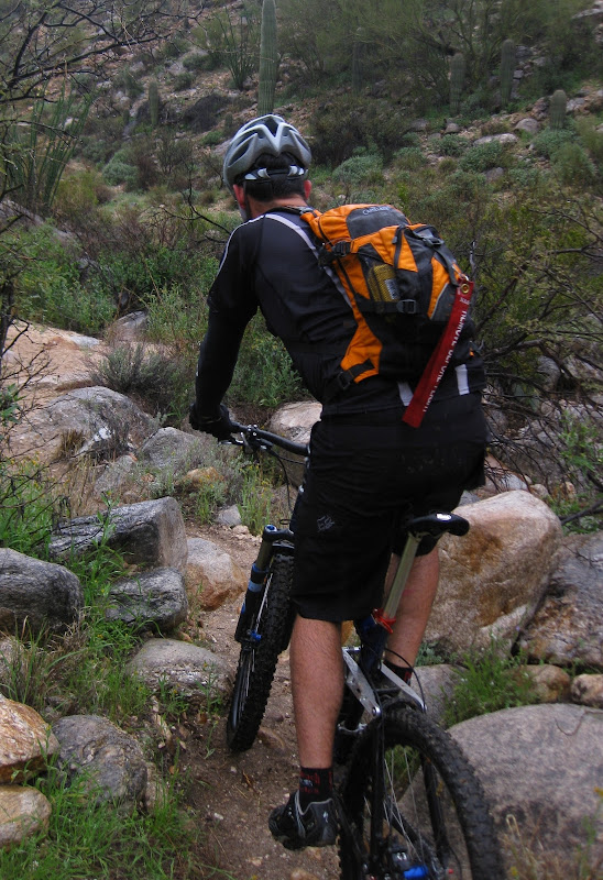
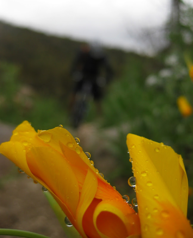
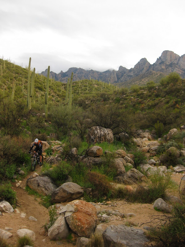
I managed to make another ride in the same area today (Thursday). Dave, Aaron, Duncan and I did the Ram Canyon to Alamo Canyon Loop, with the new Skipping Bypass to add more singletrack.

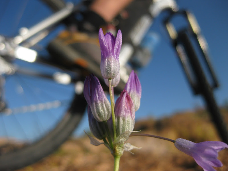
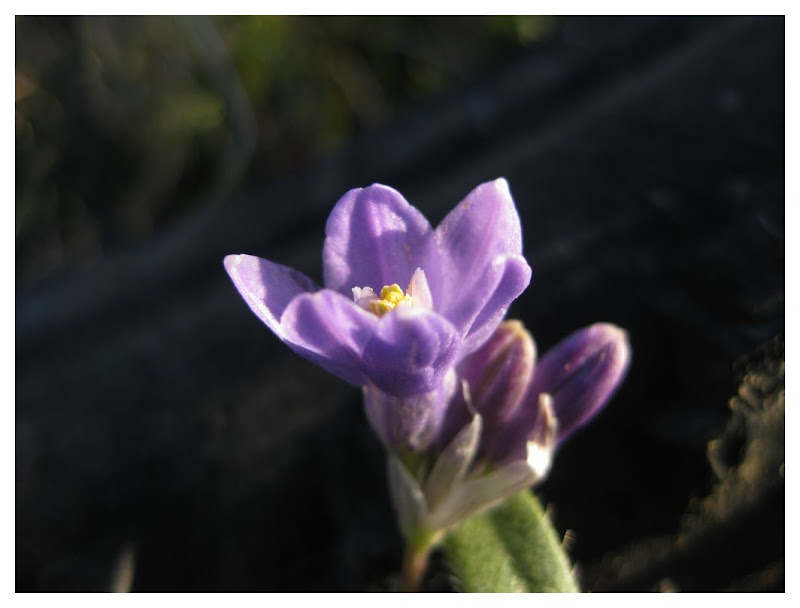
Unlike on Tuesday, things were nice and dry. Wildflowers were in full bloom.


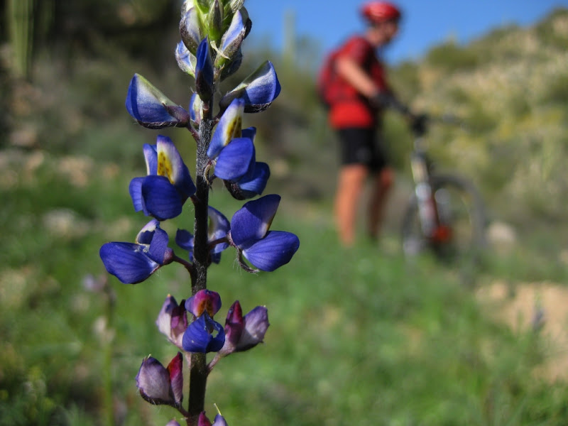
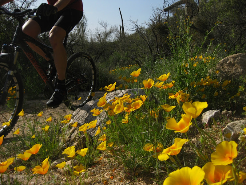
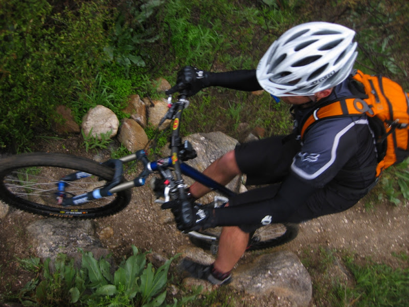
During a few moments of sessioning, I was able to take pictures. Things started off horribly for me at the beginning; opting for the photographer role was very fitting.

As the day progressed, things started looking up. I even cleaned some stuff I missed last Tuesday.


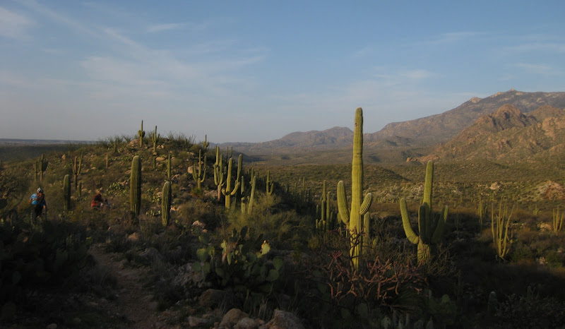
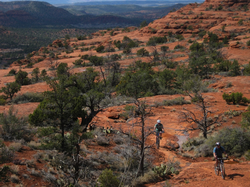
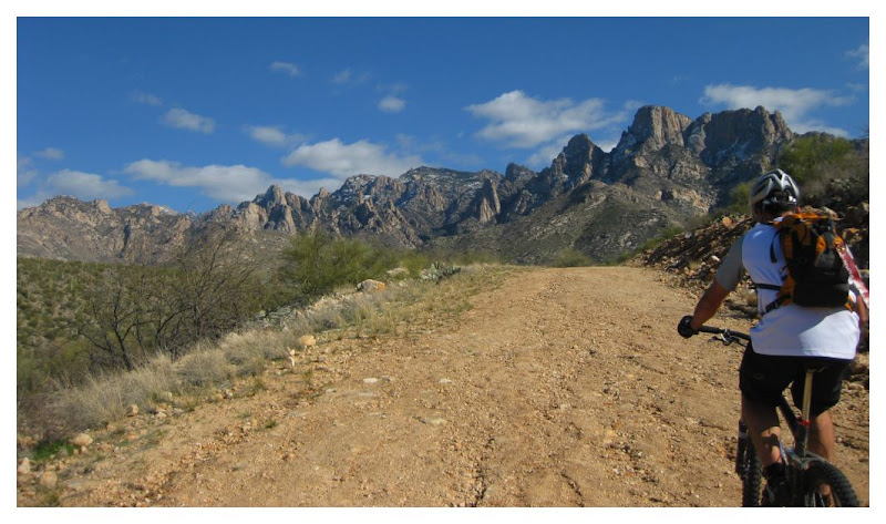
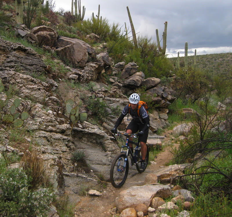
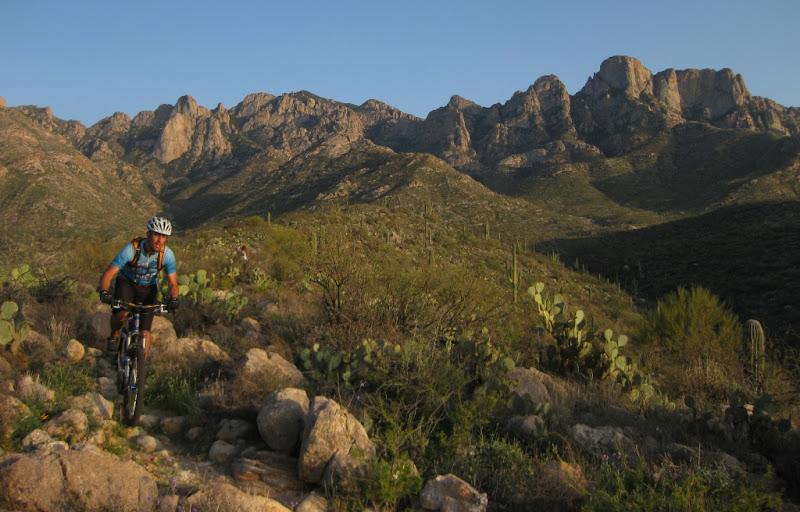
Views like this speak for themselves. Even if the trail was mediocre, the views would be enough to keep me coming back for more and more. In fact, I often think I could ride on such trails everyday, all day.


A great week of rocky riding and a near week of bikepacking on the horizon.

Thursday, March 18, 2010

Sedona Big Friggin' Loop


by Sedona Dream Photos

More pictures are available here.

Oak Creek had a pretty moderate flow at the beginning of the race, although it quickly increased as the day began to get hotter thereby increasing snow melt. At the end, there were only 6 finishers that crossed the nearly 500 cfs Oak Creek River. Pretty epic. Surprisingly, each one of those finishers only had good things to say about the route. Look for an updated route next year, perhaps a different direction.

Tuesday, March 16, 2010

Redo

The Rubio's seemed to be having trouble when we first arrived to meet today. The power in the immediate 4 blocks surrounding Rubio's was completely out, a bad omen for the ride ahead...failure.

Scott seemed to have come prepared by bringing the "big bike." Others of us were not so lucky, failure mechanically.

This is the easy part of the descent.


Duncan, Dave and Scott in the relentless push to the top.


Duncan had some issues with the bike allowing Scott and I to look for some B lines...


Calling redo is always a sign of perseverance never a sign of failure. 4 people and about 15 attempts later, it was still left to continue. Left for another day, perhaps someone else.


Another mishap left a few of us waiting...in good company though. Check out that background.


The final, technical descent down Alamo Canyon is probably the hardest of the entire area. Shouts typically ring out as people are cleaning moves, narrowly scraping their derailleur on some rock, almost crashing.


Only one question remains...next week,when we go up Alamo Canyon, who will clean what and how long will it take to ride that steep, rocky 1.5 miles?

AZSF 2010 in pictures


Thursday, March 11, 2010

Ram and Alamo Canyon

Duncan, Marie and I met at Rubio's for a quick 2-hour tech fest up Steam Pump Trail. Brillant scenery, even on the optional longer, steeper double track was chosen instead of the easier, flatter singletrack.


Steep and rocky on the climbs help with the ride description..."techy".


Cactus vs rock...who will win?


Looking over to 50 Year Trail from Alamo Canyon. Charleau Gap is the U shaped ridge line on the right.


Sums up the ride...


March is the month of wildflowers for AZ...


First attempt....near miss.


Try, try again....success!


My second wild poppy of the season...this place was crawling with them.


This is near rock that stole my derailleur and hanger on Tuesday's ride. Complete new chain, derailleur, cassette, and a present from Scott...a new titanium 21-tooth chain ring.

Nearly all singletrack.... there are plenty of out-n-back options, more importantly, there is more exploration needed. I'd compare Alamo Canyon Trail to the Upper 50 with a dash of Milagrosa. Steam Pump/Ram Canyon mirrors the 50 year trail.

Any takers on the next Tuesday Techy Taco Ride to see some new trail, perhaps even discover some new "trail"?

Wednesday, March 10, 2010

Alamo Canyon

I managed to leave the camera in the car on Tuesday's first ride in Ram Canyon. The following picture are courtesy of Duncan.


We rode despite the onslaught of wind and rain.


I had to dig in the Goodwill bag in the back of my car for a sweater.


Pretty sweet, new trail close to work. Some of this could be connected to Catalina State Park and 50 Year pretty easy, along with the Honeywell singletrack. There could be a nearly all dirt route from my work out to the 50 Year Trail!

Sunday, March 07, 2010

Tortolita Loops

Lately, I have been obsessed with the Tortolitas. It's the last semi-wild mountain range that surrounds Tucson. The GPX network of dirt roads, double track, cow singletrack, and trail now is at ~170 miles. While it is not all fun rideabe singletrack, it underscores my belief that the Tortolitas will be the next great trail network in Tucson.

Each time I ride out there, I come back home and look over aerial maps on Topofusion. For the average mountain biker, this may seem silly. On the contrary, it really gets me fired up and it allows me to get out in nature...a kind of solitude, if you will, while still maintaining a close distance to Tucson.

Here is a classic example of said aerial map:


Look closely. Do you see the next "trail" that could lead east to Honeybee Canyon?

This "trail" is off Como Trail, which was part of the Tortolita Tour that we did yesterday. After giving up on the SS a few months ago, I found a new passion for exploring and climbing techy, rocky stuff. The Tortolitas offer all of this pretty close to home; I can see most of the Tortolitas from my house and work.

The challenging part about the Tortolitas is connecting known trail sections together for viable loops.I see 3 different options that veer off of Como Trail, shown here in red (most probable), purple, and blue.


The only thing to do now is trace it out on Topofusion and go ride it. Do you want to go?

LinkWithin

Related Posts Plugin for WordPress, Blogger...